
Location Efficiency
Before beginning a scenario planning process, it is helpful to first understand local context, or location efficiency. Envision Tomorrow includes several analysis tools that help planners understand location efficiency through spatial analysis. These tools look at the balance of jobs, housing, worker wages, and household incomes across a region. They can also be used to understand the quality of pedestrian infrastructure in an area, or where to site schools, police, and fire facilities.
The Location Efficiency Tool
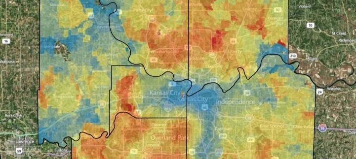
Before embarking on a small-scale planning analysis, it is often useful to screen larger areas based on a multi-criteria analysis. Whether siting transit stations, schools, police stations, or supermarkets, a composite scoring approach that considers multiple factors can help produce a robust and transparent analysis. The Location Efficiency Tool is designed to consume a number of factors related to urban form, demographics, and the real estate market. It was constructed to function as a GIS-based multi-criteria analysis application that allows users to define and weight up to four factor groups which can contain an unlimited number of factors. Each factor can be plotted using a raster-based “heat map.”

The Workforce-Housing Balance App
When jobs and housing are located in close proximity, the need for long commutes can be reduced. Workers who live near their jobs may choose to take public transportation, bike, or walk as an alternative to driving. When all people in an area live in proximity to where they work, it is referred to as a job-worker balance. The Workforce-Housing App generates summaries of jobs-worker and wage-income balance at the Census Tract level within a user-specified commute-shed.